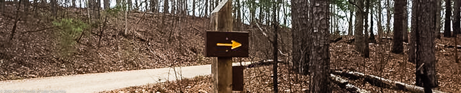
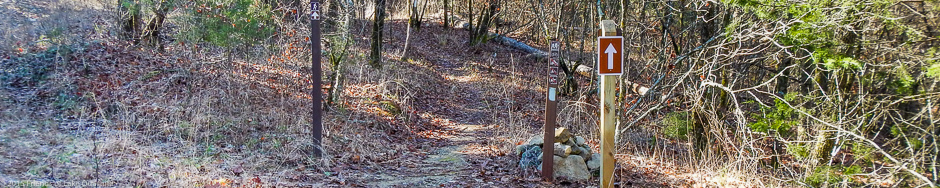
Traildogs Ron Mayfield and Robert Cavanaugh put up 13 trail signs where the trail comes down Hickory Nut Mountain and along the intersections of the LOVIT and FS 47. Six of the signs were placed on Hickory Nut Mountain. Four of these were on two posts where the trail comes down to Hickory Nut Mountain Road (FS Road 50) from the trailhead, and two were placed on a post near the kiosk/trailhead. Another was placed at the intersection of FS 47A and FS 47. Four went on bare posts previously placed along FS 47, and one replaced an arrow that was missing. We put one more near the old pavilion near Crystal Springs. This should help hikers and bikers stay on the trail. Robert and Ron also cut 10 or 11 trees off of the short section between the Gap Creek Bridge and Hwy 270. This area had not been …Click to read the full article
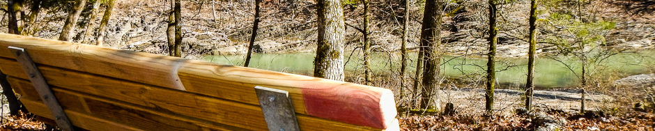
Today, a number of Traildogs installed a new bench along the Trail’s 5th section between USFS Road 47A and Pipe Spring. The bench, sponsored by Mike Hardage to honor Wanda Hardage, sits about 30 yards off the trail and overlooks a beautiful beach along Walnut Creek a bit south of where it dumps into the cove occupied by the Crystal Springs Marina.
Apologies for the late notice, but we’ve just been informed by Forestry that there will be a controlled burn from the area along Walnut Creek near the Charleton Campground back toward the Crystal Springs area. The burn is expected to be set at around 3 pm today, March 6, 2016. If you were planning to be on the LOViT in the area from Forest Service Road 47A to Crystal Springs Road today or in the next couple of days, you will want to be aware of this activity. The Forest Service will be placing signs in the area today to make folks aware of this upcoming controlled burn.
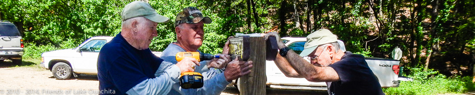
Four Traildogs – Al, Mike, John, and Dan – met Friday, Jan. 8, 2016, to set two posts for future directional signs where the LOViT crosses Hickory Nut Mountain Road, and then to hike Section 4 east to the trailhead for Section 5 at USFS Road 47A. The goal of the hike was “recon” – to evaluate the shape of the trail segment for any problems that need to be added to the winter maintenance schedule. After placing the posts, the recon hike was mostly uneventful, which is a Good Thing! We were able to move three fallen trees off the trail, two of which needed a little prodding from a small hand saw. Also, we noted a couple of areas that are in need of water bars in order to deflect rainwater off the trail to prevent erosion. And, no recon hike is complete without carrying loppers and shears …Click to read the full article
It is winter and time to hit the Trail for a number of maintenance projects that are never fun during the heat of summer, so today, five Traildogs met at the trailhead at USFS Road 47A to place a number of new directional signs along LOViT’s Section 5 from FS47A east to Pipe Spring. This section of the LOViT both crisscrosses USFS 47, which runs between Hickory Nut Mountain Road to the west and Crystal Springs Road to the east, and also follows along USFS 47 at times before sinking back into the Ouachita National Forest. It’s easy to miss a turn. Overall, the day was beautiful, and, for the most part, the digging was not too difficult, although we did have to relocate a couple of times due to hitting a shelf of shale. Once a hole was dug, a post was set in concrete, leveled, and then the signs were …Click to read the full article
Four years of storms and neglect were remedied last Friday when six Traildogs spent the day improving Section 5 of the Trail where it parallels and crisscrosses US Forest Service Road 47 between Crystal Springs Road and Hickory Nut Mountain Road. We worked the part of this section from the FS47A trailhead at the eastern base of Hickory Nut Mountain to Pipe Spring, where the LOViT joins the Charlton Trail leading to the Crystal Springs Campground Pavilion. We sought to improve access and signage at each entrance and exit point along the road. We started at the intersection of FS47 and FS47A, where we installed an assurance directional sign post. The post directs users to follow FS47A 1/4 of mile north to where the Trail turns left and proceeds west to the summit of Hickory Nut Mountain. We also installed a new sign at the FS47A trailhead. We cleared all …Click to read the full article
It’s hunting season in Arkansas, and because the Lake Ouachita Vista Trail is primarily located in the Ouachita National Forest, you must be aware of the potential for hunters to be on or near the Trail. Here are the “Hunter Orange Requirements” as published by the International Hunter Education Association: Arkansas (A) It is unlawful to hunt wildlife, or to accompany or assist anyone in hunting wildlife, in zones open to firearm deer, bear, or elk seasons, without wearing an outer garment, above the waistline, of daylight fluorescent blaze orange (Hunter Orange) within the color range of 595-605 nanometers or flouorescent chartreuse color range of 555nm – 565nm (Hunter Safety Green) totaling at least 400 square inches, and a hunter orange or hunter safety green head hat must be visibly worn on the head. (B) Florescent blaze orange (Hunter Orange)or florescent chartreuse (Hunter Safety Green) totaling at least 144 square …Click to read the full article
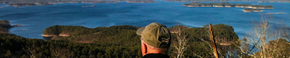
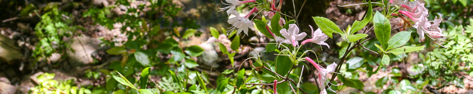
After our “second winter this spring,” we gathered on Hickory Nut Mountain today for a ID & photo hike of the flora on the south slope of the mountain. The second winter had slowed the bloom of the iris and other spring bloomers, but it was a near perfect afternoon for a hike. We had seven hikers for this three mile adventure, again armed with Carl Hunter’s Wild Flowers of Arkansas book and several cameras. After shuttling a vehicle down to the eastern end of this mountainous section, we were off on this really nice downhill hike. Despite the recent rains, the trail was not muddy, and it appeared only a small amount of rain had fallen on the mountain. We did find several old friends blooming along the trail, including the Hairy Spiderwort, Fire Pinks, and Huckleberries laden with blooms. One special find unique in this area was two blooming …Click to read the full article
Friday, Jan. 11, 2013, we had five Traildogs working the storm cleanup on Section Four Between the trailhead at Hickory Nut Mountain and Forest Service Road 47A. It was good to visit this this 3.2 mile section along the southern face of Hickory Nut Mountain again as it is one of the most scenic sections, especially after a rainfall. Hickory Creek that begins on the summit of the mountain was pure eye candy for our team as we cleared downed trees and limbs. This deep drainage creek creates one waterfall after another as it rushes down the gorge and empties into Lake Ouachita. The area around the artesian spring was highlighted by a set of twin falls just to the north of the spring a sight well worth a hike. We were able to completely clear this section from the Hickory Nut Mt. trailhead to the intersection of U.S. Forest …Click to read the full article