We hope you enjoy your time visiting our website, and that you have a wonderful and safe experience along the Lake Ouachita Vista Trail and the beautiful area through which it runs.
The posts on this "Home" page let you know what's happening on and around the Trail. The rest of the pages on the site introduce you to the Trail segments, the history of the LOViT and of Lake Ouachita, and to the "Traildogs", volunteers who maintain the existing trails and work with the US Forest Service, the US Army Corps of Engineers, and others to create new trail segments. We also include maps of the trails (this is always a work in progress), and we provide information about amenities and places to stay in the area.
Please consider a tax-deductible donation to Friends of Lake Ouachita in support of the Lake Ouachita Vista Trail. Thank you!
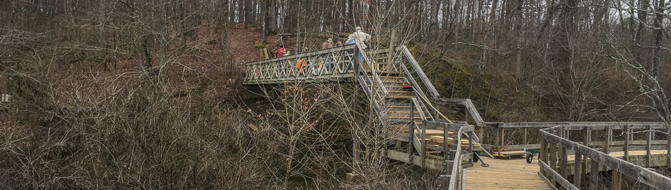
The Trail especially needs your help now because of the failure of the Elevated Walkway over Gap Creek and Lake Ouachita.
The Lake Ouachita Vista Trail traverses U.S. Forest lands that have long been popular hunting grounds in all seasons. All Trail users should be aware of these activities and not wear clothing that could be mistaken for wildlife. Bright colors and hunter orange eliminate most instances of mistaken identity. See this Arkansas Game and Fish "Hunting Seasons" link for more information.
Very unfortunately, the existing Elevated Walkway on the Lake Ouachita Vista Trail had deteriorated and become unsafe. A decision was subsequently made to remove the Elevated Walkway and to hopefully replace it with more modern materials that would last much, much longer than the previous structure. A number of Traildogs, led by Jerry Shields, have begun a project to define the replacement structure with materials that are better equipped to last a long time. Needless to say, the expected cost of replacing the Elevated Walkway will be substantial, and we are therefore hoping all who enjoy the LOViT, and especially the Elevated Walkway, will be able to contribute to the cost of rebuilding. You may do so by clicking on the “Donate” icon on the home page. Below is a link to the “Elevated Walkway Replacement Proposal” for your consideration. Many, many thanks to you for your consideration from all …Click to read the full article
Saturday, September 25, 2021 8:00 am to 11:00 am Tompkins Bend Day Use/Picnic Area, Shangri-La Road, Mt. Ida, Arkansas Water, Restroom, free parking, hand sanitizer, and trash bags will be provided. Volunteers are encouraged to bring gloves, grabbers, bug and sun protectors and anything else they might need.It is an easy way to make a difference in your community…find something you and your whole family can do together or bring a group of your friends along. Use your boat or take a hike. Trash that is picked up is left on the boat ramp and will be picked up and hauled away. Hosted by the Friends of Lake Ouachita (FOLO) and the US Army Corps of Engineers and Keep America Beautiful and Keep Arkansas Beautiful.
Attached are photos of some of the ongoing issues faced with the management of the Lake Ouachita Vista on Hickory Nut Mountain. Over the Memorial Day weekend, there were large crowds on the mountain, filling the campground with extra campers spilling out into the nearby woods and many along FS Rd 47 between FS RD 50 and Crystal springs Rd. Two of us traildogs went up the mountain on Tuesday, June 8, 2021, to pick up litter and look for further damage after we received photos of two vehicles parked on at the Vista, one of whom decided it would a great idea to pull the front wheels of his jeep up onto the Vista’s wall. Fortunately, someone took photos of this event and sent them to the sheriff’s office and to our email. We are actively trying to identify the jeep owner and have requested the U.S. Forest …Click to read the full article
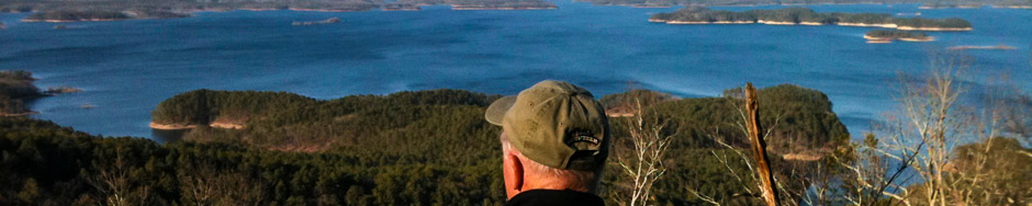
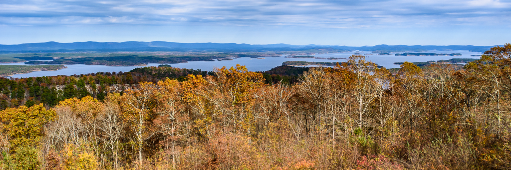
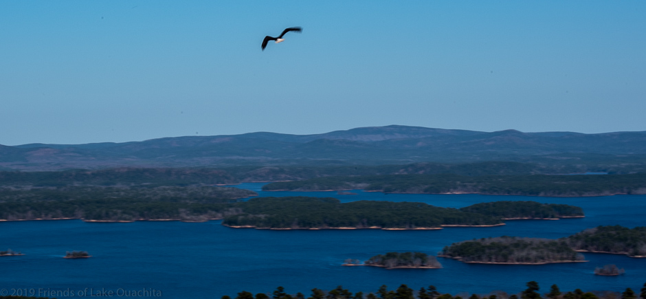
Volunteers from the Friends of Lake Ouachita (FOLO) and the LOViT Traildogs met atop Hickory Nut Mountain at the Lake Ouachita Vista parking area this past week, January 19, 2021, for a “Pickup & Clean UP The Mountain” event. The over sixty-year old recreation area atop the mountain includes a large rock-lined vista with a spacious parking area. The north side of the Vista offers unparalleled views of Lake Ouachita and its tree-carpeted islands almost a thousand feet below. The south side of the Vista falls away into a lush valley stretching east to Crystal Springs and west to Mt. Ida. The Vista has once again become a magnet for unique events such as the star watching of the conversion of the planets and annual meteor shower displays brilliantly seen from the mountaintop, unfettered by light pollution. In recent years, the Vista has served as the launching site for rehabilitated Bald Eagles to …Click to read the full article
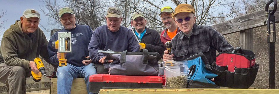
Shane Scott, Matt Williams, Ron Mayfield, and Robert Cavanaugh put up a new directional trail sign at the second boulder crossing east of Crystal Springs Road this morning. We came back toward Shangri-La Road and removed the three fallen trees from the LOVIT between Sunset Vista and Homestead. Lots of carrying tools, concrete, chainsaws etc. We enjoyed a nice morning on the trail with good friends. We finished up with pie at Shangri-La. (Article stolen from Robert’s Facebook page!)
On May 4, 2019, over thirty friends, family, colleagues and trail enthusiasts gathered at the elevated Watchable Wildlife walkway section of the Lake Ouachita Vista Trail (LOViT) to celebrate Tom Ferguson’s life and long career. Tom was an outdoorsman’s outdoorsman. He enjoyed opening the beauties of nature to any and all that could keep up with his long stride in his many forays into the wilds of nature. Tom was known throughout the U.S. Forest Service (USFS) as a man who enjoyed the complexities of nature and its impact on those who enjoyed the adventure of a hike through an untamed forest. He was part of the first teams to explore the possible creation of what is now known as the LOViT Trail. Tom along with other USFS trails professionals scouted the Ouachita Mountains bordering the southern shore of Lake Ouachita searching for the best possible route. Tom seemed to always …Click to read the full article
A handful of Traildogs showed up today to add three new benches on the Elevated Walkway section of the Lake Ouachita Vista Trail. No matter how big or small the effort, it’s always a fun day filled with many laughs.
Comments from Stacy Sigman, Oct. 16, 2018: Good afternoon. On behalf of the U.S. Army Corps of Engineers, Mississippi Valley Division, Vicksburg District, I would like to thank everyone for coming to this special awards ceremony. Specifically, I would like to thank Greg Miller, Chairman for the Corps Foundation, for traveling all this way to present the ENDURING SERVICE VOLUNTEER AWARD. For those you who do not know Jerry Shields, I would like share of few words. Jerry had a 35 year career with AT&T. He started out as grade-one machine operator on the factory floor. He attended night classes for 9 years in order to attain his Bachelor of Science Degree. Ten years later, Jerry spent three years in night classes, achieving his Masters. Five years later he was chosen to pursue his Doctorate in International Business and then promoted to Vice President of Asia Pacific contracting based Hong Kong. As …Click to read the full article
Local Traildog volunteers gathered near Denby Bay of Lake Ouachita the week of January 14, 2019, to repair the planking on the trail bridge over the Gap Creek part of the ADA (Americans with Disabilities Act of 1990) Watchable Wildlife handicap accessible portion of the 45-mile-long LOViT trail system. The Gap Creek Bridge was originally constructed by a trail coalition team in 2010, lead by the US Corps of Engineers, and supported by the Traildog volunteers, with funding through a grant from the Arkansas Game & Fish Commission. The thirty-foot-long pedestrian bridge is a low maintenance structure made of structural fiber and wooden planking. It rises almost twenty feet above the creek bed and is above the Lake Ouachita’s high water mark. During the construction stage, the Corps of Engineers constructed a temporary road from the Old Highway 270 road, known locally as “Blow out Bridge Road,” to the construction …Click to read the full article
One of the highlights of the Christmas season this year was an event atop Hickory Nut Mountain a few days before Christmas. Over two hundred people crowded the parking area of the old vista area to witness the release of a rehabilitated bald eagle back into the wild. It was a stirring site to see this magnificent bird that had been struck by a vehicle almost a year ago suddenly leap into the air with a mighty push of its now repaired wigs and soar down the slopes of the mountain to the lake surface almost a 1000 feet below. It was heartening to see so many people on the vista all gathered to wish the old eagle well and to drink in the beauty of the view on a sparklingly clear day. There were so many vehicles the large parking lot could not accommodate the crowd, forcing latecomers to …Click to read the full article